Cranberry Peak is in the Bigelow Preserve with zero cell reception. Weather changes quickly at 3,200 feet. Bring a map, extra layers, and tell someone your plan before heading out. This is not the place to rely on your phone for navigation.
The Bigelow Range’s Overlooked Neighbor
Everyone who hikes in western Maine knows the Bigelow Range. Avery Peak and West Peak dominate the skyline, their long ridgeline visible from every direction. Hikers come from all over New England to bag them. And almost all of them drive right past Cranberry Peak without a second glance.
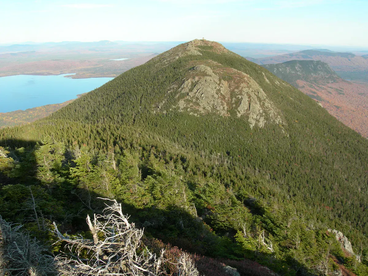
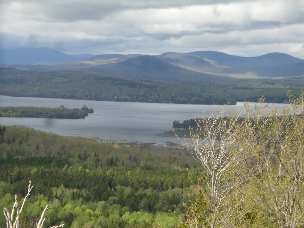
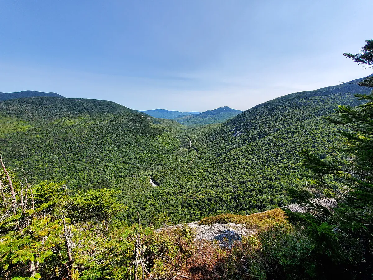
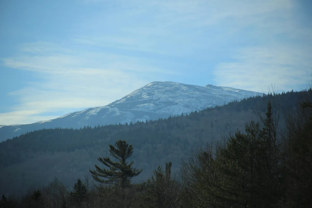
That is a mistake. Cranberry Peak sits just south of the main Bigelow ridge at 3,213 feet, and from its open summit you get what might be the best vantage point of the Bigelows themselves. The entire range stretches out in front of you, Avery Peak’s fire tower visible on the left, West Peak’s bald summit on the right, and the long connecting ridge between them laid out like a topographic map come to life. Add Sugarloaf’s ski trails to the south, the Crocker Mountains to the southwest, and Flagstaff Lake glinting to the north, and you have one of the finest panoramas in Maine.
The difference is that you will probably have it to yourself. On a Saturday in August when the Bigelow Range Trail has a steady stream of hikers, Cranberry Peak might see a handful. The trail is well-maintained, the distance is reasonable, and the views rival anything in the western mountains. It is one of the best-kept secrets in the region.
The Bigelow Preserve: 36,000 Acres of Wild
Cranberry Peak sits within the Bigelow Preserve, a 36,000-acre swath of protected wilderness that owes its existence to one of the most consequential conservation votes in Maine history. In 1976, a developer proposed building a massive ski resort across the entire Bigelow Range. Maine voters rejected the plan in a statewide referendum and the land was permanently protected.
Today the Preserve is managed by the Maine Bureau of Parks and Lands. There are no entrance fees, no reservations, and no crowds. Just boreal forest, alpine terrain, and some of the most honest mountain hiking in the Northeast. The trails are maintained by the Maine Appalachian Trail Club, and they do excellent work keeping the routes clear and well-blazed.
Trail Sections
Currie Road Trailhead to Hardwood Forest
The trail begins at a small pull-off on Currie Road outside Stratton. The first section climbs gently through a beautiful northern hardwood forest: sugar maple, yellow birch, and beech. The footing is packed dirt with occasional roots and rocks. The grade is mild and the walking is pleasant. Enjoy the canopy; this forest puts on one of the best foliage shows in Maine come September.
Transition Zone
The trail steepens noticeably as the hardwoods give way to spruce and fir. The path narrows and the rocks underfoot get larger. You are gaining steady elevation now, and the forest takes on the dark, mossy character of the boreal zone. The trail is well-blazed with blue markers. A few stream crossings (usually dry by midsummer) break up the climb.
Upper Mountain and Scramble
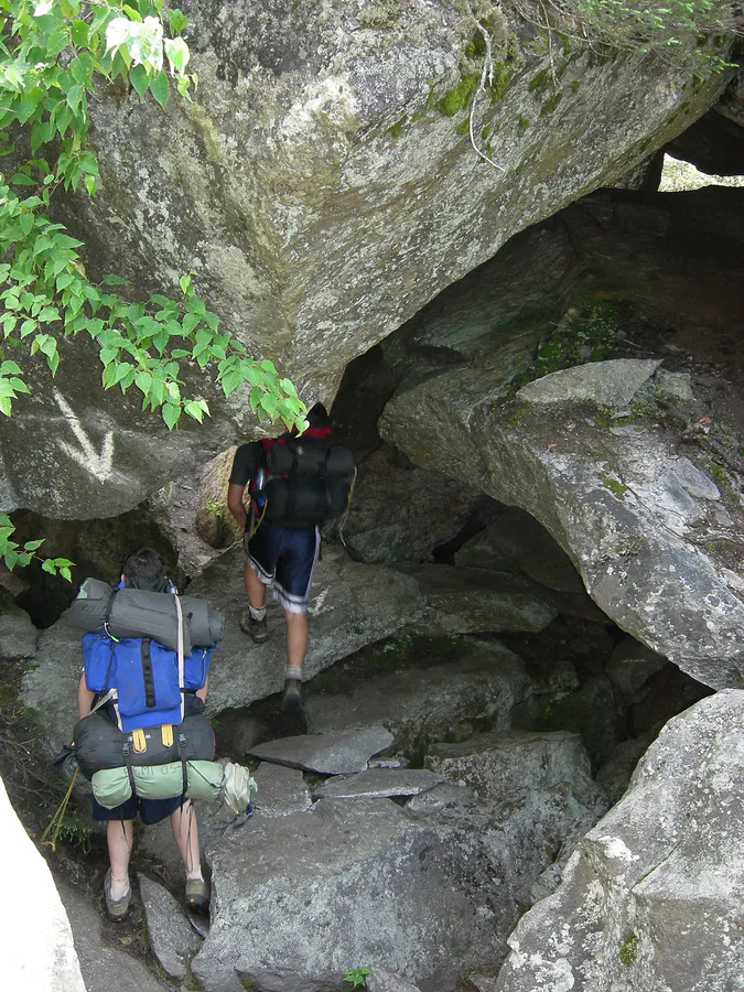
The final push to the summit gets steep. The trees shrink to scrubby spruce and balsam fir, and the trail becomes rockier with a few spots where you will want to use your hands. This is not technical climbing, just steep, rooty scrambling over exposed bedrock. The forest thins as you approach the summit, and glimpses of the Bigelow Range start appearing through the trees.
Summit
The final approach opens onto exposed granite with low scrub. The summit of Cranberry Peak is a broad, open ledge with 360-degree views. There is plenty of room to spread out, eat lunch, and take it all in. On a clear day, the views extend from Katahdin to the northeast all the way to the Presidential Range in New Hampshire to the southwest.
What You Will See from the Top
The summit panorama is the reason to hike Cranberry Peak. Here is what you are looking at, moving clockwise:
North: The full Bigelow Range dominates the view. Avery Peak (4,090 feet) with its fire tower sits to the northeast, and West Peak (4,145 feet) anchors the western end. The Horns, two sub-peaks on the ridge, are visible between them. Flagstaff Lake stretches out beyond the range, a long finger of water created when the Dead River was dammed in 1950.
East and Southeast: Sugarloaf Mountain is unmistakable with its ski trails carved into the face. At 4,237 feet, it is the second-highest peak in Maine and the tallest mountain you can see from here.
Southwest: The twin summits of Crocker Mountain rise across the valley. At 4,228 feet (South Crocker) and 4,168 feet (North Crocker), they are among Maine’s 4,000-footers and make a natural companion hike if you have a second day in the area.
West: The rolling western Maine mountains stretch toward the New Hampshire border. On exceptionally clear days, you can pick out the northern Presidentials.
When to Go
Spring
Snow lingers at elevation into May. Mud season makes the lower trail a slog. Black flies are fierce in late May and June.
Summer
Dry trails, long days, blueberries on the summit in August. Bring bug spray through mid-July.
Fall
Peak foliage in late September to early October. The hardwood forest below is spectacular. Cool temps, clear skies.
Winter
Snowshoes or microspikes required. Short days and cold temps at elevation. No cell service makes this a serious winter outing.
The lower hardwood section of this trail is one of the best foliage hikes in western Maine. Peak color typically hits the last week of September through the first week of October. Time it right and you walk through a tunnel of gold and orange on the way up, then see the full painted landscape spread out from the summit. The combination of summit views and low-elevation foliage is hard to beat anywhere in the state.
What to Bring
What to Bring
- Sturdy hiking boots (rocky and rooty upper sections)
- 2-3 liters of water (no reliable water sources)
- Rain jacket and extra layer (weather changes fast at 3,200 feet)
- Map or downloaded GPS track (no cell service)
- Lunch and snacks for the summit
- Trekking poles (helpful on the steep descent)
- Bug spray (essential through mid-July)
- Sunscreen for the exposed summit
Trekking poles are worth bringing on this one. The descent is steep enough and long enough that your knees will thank you, especially on the rocky upper section. Proper hiking boots with good ankle support are recommended over trail runners due to the rooty, uneven terrain in the transition zone.
Dog-Friendly Notes
Cranberry Peak is dog-friendly, and it is a good one for strong hiking dogs. There is no technical scrambling that would require lifting your dog, and the trail is wide enough throughout. Bring extra water since there are no reliable sources on the trail. Keep your dog leashed near the summit, as the exposed ledges have steep drop-offs on the north side. The upper scramble section may require some encouragement for less experienced trail dogs, but nothing that should stop a reasonably fit dog.
Combining with Other Hikes
If you have more than one day in the Stratton area, the hiking options are outstanding. The Bigelow Range is the obvious next step, a much longer and more demanding day that traverses Avery Peak and West Peak along the Appalachian Trail. Sugarloaf Mountain offers a steep climb to Maine’s second-highest summit. Crocker Mountain gives you two 4,000-footers in a single out-and-back. All three trailheads are within 20 minutes of Cranberry Peak.
For a shorter outing to pair with Cranberry Peak on the same day, drive north to the Flagstaff Lake shoreline for a swim and a rest. The lake is cold, clear, and rarely crowded.
FAQ
How hard is Cranberry Peak?
It is rated moderate, but the 2,000 feet of elevation gain over 2.9 miles of uphill makes it a solid workout. The trail is well-maintained and the route is straightforward. The upper section has a few spots where you use your hands, but nothing technical. If you hike regularly and are comfortable with sustained climbs, you will be fine.
How long does Cranberry Peak take?
Plan on 3.5 to 5 hours for the round trip, depending on your pace and how long you spend on the summit. The ascent typically takes 2 to 2.5 hours, and the descent is a bit faster at 1.5 to 2 hours.
Is there water on the trail?
There are a few stream crossings in the transition zone, but they are unreliable, especially in late summer. Bring all the water you need. Two to three liters is the right amount for most hikers on a warm day.
Can I camp at Cranberry Peak?
Backcountry camping is allowed in the Bigelow Preserve, but there are no designated sites on the Cranberry Peak trail. Practice Leave No Trace principles: camp at least 200 feet from trails and water sources, and pack out everything you bring in.
Getting There
The trailhead is on Currie Road in Stratton, Maine. There is no entrance fee for the Bigelow Preserve.
From Stratton: Head east on Route 27 and turn left onto Currie Road (also called Rapid Stream Road on some maps). Follow the dirt road for approximately 1.5 miles to the small trailhead pull-off on the right. The road is passable for regular vehicles in summer and fall but can be rough in spring.
From Portland: Take I-95 north to Augusta, then Route 27 north through Farmington and Kingfield to Stratton. About 2 hours and 45 minutes.
From Bangor: Take I-95 south to Newport, then Route 2 west through Skowhegan and Route 16 west to Stratton. About 2.5 hours.
Parking: The pull-off fits roughly 6 to 8 vehicles. No restrooms at the trailhead. The nearest services are in Stratton, about 10 minutes away. There is no cell service at the trailhead or anywhere on the mountain.